Anthropologist Frank Speck 1881-1950

Speck

Frank Speck with Standing Deer in Cherokee, NC in 1936.

Frank Gouldsmith Speck (November 8, 1881 – February 6, 1950) was an American anthropologist and professor at the University of Pennsylvania, specializing in the Algonquian and Iroquoian peoples among the Eastern Woodland Native Americans of the United States and First Nations peoples of eastern boreal Canada.

Born in Brooklyn, Speck was sickly as a child. His parents sent him at age seven to live with a family friend, Fidelia Fielding, in Mohegan, Connecticut in hopes that the rural environment would improve his health. She was a widow and Native American, the last speaker of her Indigenous, Mohegan Pequot language. While living with her, Speck acquired “his interests in literature, natural history and Native American linguistics.”

Speck spent most of his professional life in the field with Native people.  He was adopted into the Seneca in the Turtle Clan.  Instead of focusing on the western tribes, as was popular at the time, he focused on eastern tribal “salvage anthropology,” salvaging what was left of the culture of endangered, extinct or nearly extinct tribes.

You can read more about him here:  http://en.wikipedia.org/wiki/Frank_Speck

Speck’s papers were collected and archived by the American Philosophical Society, of which he was a member.  There are also collections of his papers at the Canadian Museum of Civilization in Gatineau, Quebec and at the Phillips Library of the Peabody Essex Museum in Salem, Mass.

It looks like the majority of Frank Speck’s papers are at American Philosophical Library in Philadelphia.

http://www.amphilsoc.org/mole/view?docId=ead/Mss.Ms.Coll.126-ead.xml

Some of his teaching notes at the University of Pennsylvania, below.

http://www.archives.upenn.edu/faids/upt/upt50/speck_fg.html

Speck’s work, especially his unpublished works and notes, would be of great interest.  In particular, he spent a significant amount of time in eastern North Carolina and Virginia, and his notes and interviews would take us back in time a century.  Some of the people he interviewed would have been born in the first half of the 1800s, and their grandparents, whom they may well have known personally, would have been born perhaps as early as the Revolutionary War.

Ok, who wants to go to Philadelphia?  Just think of it as Indiana Jones, but inside.

Posted in Anthropology | 1 Comment

1606 Hondius Mercator Map of “Virginia and Florida”

OLYMPUS DIGITAL CAMERA

Virginiae Item et Floridae

This map by Jodocus Hondius first appeared in the 1606 Mercator’s atlas, published by Hondius. As noted by William P. Cumming (The Southeast in Early Maps), Hondius relied primarily on de Bry’s engravings of White’s and LeMoyne’s maps of Virginia and Florida, respectively. As a result, the coastlines of South Carolina and Georgia are greatly reduced.

The Dutch archives holds this map and you can see it at this link (thanks to our friend Yvette at the archives):

http://www.gahetna.nl/collectie/afbeeldingen/kaartencollectie/zoeken/weergave/detail/q/id/af9c2338-d0b4-102d-bcf8-003048976d84

Notice the 3 separate Indian towns on Hatteras Island one on Ocracoke.  Of course, the one we all know about on Roanoke Island near the colonist’s fort is shown as well as the companion village across the sound at Dasamoriquepeuc.

Hondius 2

But aside from all the cartographic history, I love the turkey!

hondius 3

Posted in Maps, Virginia | 3 Comments

Acanahonan Found on Jamestown Map in Dutch Archives?

Jamestown map 1

Our friend Yvette in the Dutch archives has done it again.  I’m so glad she loves maps as much as I do.  This map is particularly interesting though, because it is of the James River area, near Jamestown, discovery attributed to John Smith, the founder of Jamestown, drawn by William Hole.  This, of course, dates the map to about 1608 when Smith explored the Chesapeake Bay region.  He left Jamestown in October 1609, for England, due to a gunpowder accident.  In 1614, he was exploring the New England region, but did not further explore the Chesapeake, at least as far as I can find.  Smith died in 1631 in England.

This map was included in the 1624 book, The Generall Historie of Virginia, New-England, and the Summer Isles.

Here is a link to the entire map.  I love the Dutch archives and how they handle maps.  You can enlarge and scroll around to your heart’s content without losing resolution.

This map clearly shows Point Comfort, Cape Henry and Cape Charles.

Jamestown map 2

All of these sights are the mouth of the Chesapeake Bay.  This site provides a significant amount of information about this area, militarily, along with some nice maps.  http://www.virginiaplaces.org/chesbay/chesattack.html

This older map from the Library of Congress in 1861 shows the location of all three of these landmarks.

jamestown map 3

But look again at the older James River map. It also shows the location of Accohonock.

Jamestown map 4

Jan. 2, 1608 – John Smith returns to Jamestown with information that there were “at a place called Acanahonan certain men clothed like me.”  On this map are two locations with similar names,  Accowmak or Accowmack and Accohanock.  Could one of these be Accohonock.

If you’re thinking to yourself that the spelling isn’t the same, you’re right.  Spelling was not yet standardized in the English language at that time.  And make note of something else on this map.

The word Sasquesahanougs is spelled three different ways, on the same map.

jamestown map 6

Below the drawing of the Native man, the legend says “the Sasquesahanougs are a gyant like people and thus attired.”  This is quite interesting.

jamestown map 5

Does anyone know what animal the man has hanging from his back. It looks kind of like a pig.

In any event, further down the map, where the location of the Sasquesahanougs is shown, the name is spelled two ways: Sasqusahanough flu= and Sasques_hanough.  The underscore means that there is a letter I can’t read due to the crease.

jamestown map 7

We’ve learned a lot from this map.  First, we may have a location for Acanahonan where  one of the Lost Colonist sightings took place.  Secondly, we know where the villages are located, and the chief’s homes.  Third, we know that the Sasquesahanough’s were giant-like men.

Thanks so much Yvette.  You keep on looking for those colonists!!!  The Jamestown fort location was found on a Spanish map, so why not the colonists in the Dutch Archives????

Posted in Jamestown, Lost Colony, Powhatan, Sasquesahanoughs | 15 Comments

2012 Blog in Review

I want to take this opportunity to thank everyone who follows or reads the Native Heritage Project blog.  2012 has been a banner year, especially for a first year, with over 64,000 views from 115 countries around the world.  I’ve posted 320 articles this year as a result of my research as I transcribe early historical records into the Native Names Project.

If you want to see more, like which were the most popular articles and who made the most comments, the WordPress.com stats helper monkeys prepared a 2012 annual report for this blog.

Here’s an excerpt:

19,000 people fit into the new Barclays Center to see Jay-Z perform. This blog was viewed about 64,000 times in 2012. If it were a concert at the Barclays Center, it would take about 3 sold-out performances for that many people to see it.

Click here to see the complete report.

Happy New Year all and here’s looking forward to a wonderful 2013.  Remember, if you find original records that have the names of Native people listed, please drop me a note or leave a comment.  Sharing is how this project has been built.  Thank you one and all!

Roberta Estes

Posted in Uncategorized | Leave a comment

Marquette and Jolliet 1673 Expedition

Marquette 1681 upright

Louis Jolliet (sometimes spelled Joliet) and Jacques Marquette are credited with the (European) discovery of the Mississippi River.

Jacques Marquette (also known as Father Marquette) was a Catholic missionary and explorer. He was born in Laon, France.  In 1666 he came to Québec, Canada and learned Indian languages. From 1669 to 1671 he worked in missions in Sault Sainte Marie (Michigan) and La Pointe (Wisconsin).  Around this time, he first met Louis Jolliet, who was trading with Indians in the same area.

Louis Jolliet was a French-Canadian trader and explorer .  Jolliet was born near Québec City and raised in a Jesuit seminary.  In 1668 he decided that he didn’t want to become a priest and he became a trader with the Indians instead.  From 1669 to 1671 Jolliet explored a lot of the Great Lakes region.  During that time he became a great map maker, also worked as a fur trader, and met Marquette.

In 1672, Jolliet was named leader of an expedition that would explore the northern part of the Mississippi River the following year.  Jolliet asked Father Marquette to be the chaplain of this group.

This 1681 map of the Marquette and Jolliet 1673 exploration shows a number of tribes and locations, including the iron mines, “choauanons mines de fer.”

On May 18, 1673, Louis Jolliet and Jacques Marquette departed from St. Ignace, now a part of Michigan, with two canoes and five other voyageurs of French-Indian ancestry (today’s Métis). They followed Lake Michigan to Green Bay, now in Wisconsin. They then sailed up the Fox River (Wisconsin) to a distance of slightly less than two miles through marsh and oak plains to the Wisconsin River. At that point Europeans eventually built a trading post, Portage, named for its location. From there, they ventured on and entered the Mississippi River near present-day Prairie du Chien on June 17.

The Jolliet-Marquette expedition traveled down the Mississippi to within 435 miles of the Gulf of Mexico, but they turned back north at the mouth of the Arkansas River. By this point, they had encountered natives carrying European goods, and they were concerned about an encounter with explorers or colonists from Spain. They followed the Mississippi back to the mouth of the Illinois River, which they learned from natives was a shorter route back to the Great Lakes. Following the Illinois and the Des Plaines rivers, via the Chicago Portage, they reached Lake Michigan near the location of modern-day Chicago. Marquette stopped at the mission of St. Francis Xavier in Green Bay, Wisc., in August, while Jolliet returned to Quebec to relate the news of their discoveries.

On his way back to Québec, when Jolliet was on Lake Michigan, his canoe turned over and all his precious maps and journals of his trips were lost, but he was able to replace most of the information from memory.

The party returned to the Illinois Territory in late 1674, becoming the first Europeans to winter over in what would become the city of Chicago. As welcomed guests of the Illinois Confederation, the explorers were feasted en route and fed ceremonial foods such as Indian corn.

After the expeditions, Father Marquette remained by Lake Michigan and preached among the Illinois Indians until his death in 1675.

In the spring of 1675, Marquette traveled westward and celebrated a public mass at the Grand Village of the Illinois near Starved Rock. A bout of dysentery which he had contracted during the Mississippi expedition sapped his health. On the return trip to St. Ignace, he died at age 37 near the modern town of Ludington, Michigan.

Louis Jolliet later explored other parts of Canada, such as Labrador and Hudson Bay. He died in 1700 at the age of 55 after disappearing on a canoe trip.  His body was never found.

You can read more about the expedition here:  http://library.thinkquest.org/4034/marquettejolliet.html

Thanks to Fletcher for sending the map and identifying the mines!

Posted in Expeditions, Maps | Leave a comment

Jackson County Michigan Indian Trails Map

Jackson Co Mi Indian Trails MapThis map shows the Indian Trails that traversed Jackson County, Michigan.  I wish there were more maps like it.  You can see this map in detail, along with the ability to zoom, at the following link at the Michigan archives:

http://cdm16317.contentdm.oclc.org/cdm/singleitem/collection/p129401coll3/id/23/rec/12

This map was created about 1930 and shows many different Indian trails.  The information about the trails was taken from various sources including the field notes from the land office surveys made from 1815-1825, from Farmer’s 1835 map of the Michigan Territory and from information taken from old settlers living in the vicinity.

Hat tip to Bill for sending me the link to the Michigan archives.

Posted in Maps, Michigan | 2 Comments

Lost Colony DNA Project Makes The Scientist Magazine List of Top 20 Stories for 2012

Lost colony dnaThe Lost Colony DNA project, sponsored by the Lost Colony Research Group, www.lostcolonyresearch.org, found themselves featured at number 15 in The Scientist Magazine’s Top 20 stories for 2012.

http://www.the-scientist.com/TheScientist/emails/daily/2012/12/26a.html

Original article, published on January 1st, 2012, is found at this link. http://www.the-scientist.com/?articles.view%2FarticleNo%2F31423%2Ftitle%2FLost-Colony-DNA-%2F

It’s also of note that Kerry Grens, the author of the story was honored by the North Carolina Society of Historians with an award for this article this past October.

Anne Poole (at left), my partner and Research Director, are screening for artifacts in the photo at one of our excavation sites.  Anne and I seldom are actually able to do something together at the same time, as there are lots of logistics and challenges to work on every minute of every dig with 20-40 people in the field.  Please note that my t-shirt says “Well behaved women seldom make history.”  It’s my motto, and I’ve never been accused of being well behaved!

Thanks everyone for your participation and interest.  Let’s make 2013 a great year with lots of research and let’s find those colonists!!

Posted in DNA, Lost Colony | Leave a comment

James River 1665 Map

James River 1665 mapYou just never know where a great map is going to pop up.  In this case, thanks to Yvette, one of our friends in the Netherlands, we find this one in the Dutch National Archives.  It’s a beautiful map with very clear location names.  Be sure to zoom in.  The snippet above is only a teaser!  It’s much larger.

http://www.gahetna.nl/collectie/afbeeldingen/kaartencollectie/zoeken/weergave/detail/q/id/af87e5d0-d0b4-102d-bcf8-003048976d84

Thanks Yvette!

Posted in Maps, Powhatan | Leave a comment

Chief John Ross 1861 Proclamation

Thanks to Bill, we have a copy of the Liberty Tribune of Clay County, Missouri on Friday, July 5, 1861, in which Cherokee Chief John Ross issued a proclamation as the United States headed towards the brink of Civil War.

John Ross 1

John Ross 2

Posted in Cherokee | Leave a comment

The Moravians, the Shekomeko Indians and the Gnadenhutten Massacre

Shekomeko monument

The Moravian mission at Shekomeko was founded in 1740 by Christian Henry Rauch to convert the Mahican Indians in eastern New York.  Today the location of the Mahican village is marked by the monument, above, at Pine Plains in Dutchess Co., NY.

In the late 1730s the Moravian Church established their first missionary efforts in North America near Bethlehem, Pennsylvania. The Moravian Church had been founded during the 15th century in Bohemia and Moravia. Following almost total destruction in the Thirty Years’ War and Counter Reformation, it had been revived in the 1720s.

Moravian map

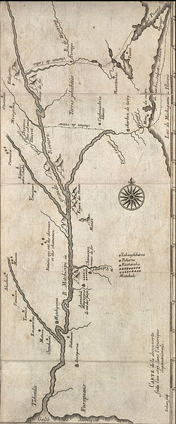
The Moravian Bishop August Gottlieb Spangenberg sent Christian Henry Rauch to New York City in 1740 on a mission to preach and convert any Native peoples he could find. Rauch arrived in New York on July 16, 1740 and met with a delegation of Mahican Indians to settle land issues. The Mahicans were an Algonquian tribe and branch of the Lenni Lenape or Delaware Nation who populated the east bank of the Hudson River in what is today eastern Dutchess County, New York, and western Connecticut.

Rauch convinced the delegation of his serious intention to instruct and teach them and Mahican Chiefs Tschoop and Shabash invited Rauch to visit their Dutchess County village. In September 1740 they led him through the unbroken wilderness to Shekomeko. There, Rauch established a Moravian mission and the two Indians chiefs were converted to the Moravian faith. In January 1742, Rauch accompanied Shabash, Seim, and Kiop on a journey to the Pennsylvania community for their baptism. Rauch’s first convert, Chief Tschoop, was lame and unable to make the journey. Upon their baptism the three were given the Christian names of Abraham, Isaac and Jacob. After the group returned to Shekomeko, Tschoop was baptized as John on April 16, 1742.

By summer 1742, Shekomeko was established as the first Native Christian congregation in America.

On March 13, 1743, the distribution of Holy Communion marked a milestone in the development of the Indian congregation. In July 1743, a Moravian chapel was built and dedicated at Shekomeko. By the end of 1743, the congregation of baptized Indians numbered 63. Two satellite missionary outposts were established in Kent, Connecticut and on the New York – Connecticut border.

The increasing Moravian influence and success in defending their burgeoning following became disturbing to the region’s white colonists. False rumors of atrocities were spread, some fearful settlers had left their farms and the authorities were petitioned to intervene. Resentment by European settlers in the area quickly grew. The Moravian missionaries exposed traders illegally selling alcohol to the Native people and provided legal advice that kept them from being cheated. Many whites resented the missionaries interfering with “nature taking its course.”

The Moravian missionaries were repeatedly detained, interrogated, fined and released. Governor George Clinton summoned the Moravians to account for their missionary activities.  Alleged to be Papist and conspiring with the outlawed Roman Catholic order of Jesuits, the Moravians successfully defended themselves and were exonerated when no link to the Jesuits could be found. However, they were admonished to cause no further suspicions.

The settlers’ enmity for the Moravians continued to grow. They persisted to oppose the Shekomeko mission and were determined to eradicate it. A law was enacted on September 21, 1744 forbidding anyone from residing with Indians in order to Christianize them.

The Moravian mission was finally doomed when the provincial assembly adopted a law on September 22, 1744 that required anyone choosing to live among the Indians to take an Oath to the Crown, obtain consent of the council and obtain a license from the Governor to do so; Moravian religious principles forbade taking oaths.

On October 27, 1744 the governor ordered the Moravian missionaries to “desist from further teaching and depart the province”. Then on December 15, 1744, the sheriff and three peace officers of Dutchess County appeared at Shekomeko under orders from Governor Clinton to give the missionaries notice to cease their teachings. The Moravian leaders were summoned to appear in court at Poughkeepsie.

The Moravians missionary venture was maintained sporadically for several years. In 1746 area settlers petitioned the governor to issue to them a warrant authorizing the killing of Shekomeko Indians. While the petition was not granted, upon hearing about the call for their extermination, the last ten families of 44 persons, all that remained of the original 8,000 member tribe 100 years before, left Shekomeko and dispersed, taking another step towards extinction.

Some sought refuge in nearby Connecticut, while others traveled to Pennsylvania to be closer to the established Moravian settlements there.

Ten families of 44 persons total arrived in Bethlehem, PA in April, 1746.  However, because an Indian settlement could not be supported so close to an existing town, the Brethren bought land for the Indians at the confluence of the Mahony and Leeha rivers, about 30 miles distant which they named Gnadenheutten.  Other Indians joined them and they eventually grew to a community of 500.

This land on the Mahoning being impoverished, and other circumstances requiring a change, the inhabitants of Gnaden-Huetten removed to the north side of the Lehigh.  The dwellings were removed, and a new chapel was built, in June 1754. The place was called New Gnaden-Huetten. It stood where Weissport now is. The dwellings were so placed that the Mohicans lived on one side and the Delawares on the other side of the street.

But this wasn’t the end of the road for the Indians.  During the Revolutionary War, in September 1781, British-allied Indians, primarily Wyandot and Lenape, forced the Christian Indians and missionaries from the Moravian villages. They took them further west toward Lake Erie to a new village, called “Captive Town”, on the Sandusky River.

The British took the missionaries David Zeisberger and John Heckewelder under guard back to Detroit, where they tried the two men on charges of treason. The British suspected them of providing military intelligence to the American garrison at Fort Pitt. The missionaries were acquitted. (Historians have established Zeisberger and Heckewelder did keep the Americans informed of the movements of the British and their Indian allies.)

The Indians at Captive Town were going hungry because of insufficient rations. In February 1782, more than 100 returned to their old Moravian villages to harvest the crops and collect stored food they had been forced to leave behind. The frontier war was still raging. In early March 1782, the Lenape were surprised by a raiding party of 160 Pennsylvania militia led by Lieutenant Colonel David Williamson. The militia rounded up the Christian Lenape and accused them of taking part in raids into Pennsylvania. Although the Lenape denied the charges, the militia held a council and voted to kill them. Refusing to take part, some militiamen left the area. One of those who opposed the killing of the Moravians was Obadiah Holmes, Jr.  Among his observations of the incident was that “one Nathan Rollins & brother had had a father & uncle killed took the lead in murdering the Indians, …& Nathan Rollins had tomahawked nineteen of the poor Moravians, & after it was over he sat down & cried, & said it was no satisfaction for the loss of his father & uncle after all”.  After the Lenape were told of the vote, they spent the night praying and singing hymns.

The next morning on 8 March, the militia tied the Indians, stunned them with mallet blows to the head, and killed them with fatal scalping cuts. In all, the militia murdered and scalped 28 men, 29 women, and 39 children. They piled the bodies in the mission buildings and burned the village down. They also burned the other abandoned Moravian villages. Two Indian boys, one of whom had been scalped, survived to tell of the massacre.

The militia collected the remains of the Lenape and buried them in a mound on the southern side of the village. Before burning the villages, they had looted, gathering plunder which they needed 80 horses to carry: furs for trade, pewter, tea sets, clothing, everything the people held.

Although there was outrage over the massacre, no criminal charges were ever filed.  However, the lesson was neither lost on the Indians, nor forgotten.

In 1810, Tecumseh reminded William Henry Harrison, “You recall the time when the Jesus Indians of the Delawares lived near the Americans, and had confidence in their promises of friendship, and thought they were secure, yet the Americans murdered all the men, women, and children, even as they prayed to Jesus?”

A cabin and cooper’s shop, along with a monument have now been reconstructed on the site of the massacre in Gnadenhutten, Ohio, and the location is on the National Register of Historic Places.

gndenhutten cabin

Posted in Delaware, Lenni Lenape, Mahican, Shekomeko | 11 Comments