
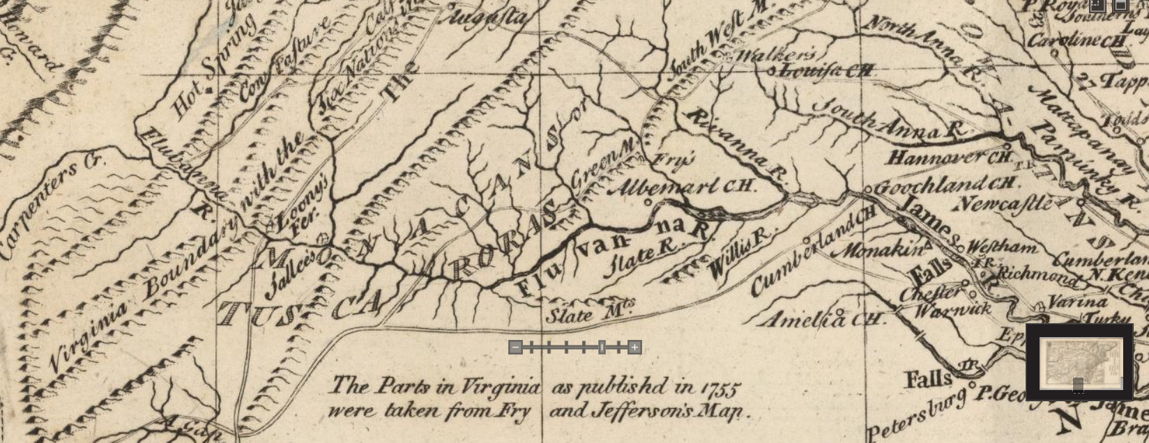
On the 1755 Lewis Evans map, in what is today Amherst, Bedford and Nelson County, Virginia, areas, the Tuscarora or Monacans are clearly marked.
The David Rumsey map collection allows you to navigate and zoom in and out on this remarkable map.
The area marked Tuscarora or Monacan is shown below.
This view is zoomed out a bit so you can get some perspective relative to the rest of Virginia and the North Carolina border.

Traditionally the Tuscarora, an Iroquoian tribe, have been located in NC, before their removal to New York in the early 1700s. The Monacan were a Siouian people. Apparently when the Tuscarora were displaced following the Tuscarora War in 1711, some settled in Virginia near the Monacan. The Monacan claim that they adopted remnant Tuscarora. Most of the Tuscarora who did not remove to New York in 1711 settled on a reservation in Bertie County, NC, but obviously, not everyone. There was enough of a settlement to be recorded on this map in 1755 with the Monacan.
According to the Monacan Indian Nation website, as late as 1742, this area near current Lynchburg was virtually unsettled by Europeans. By 1758, the Monacan were proving “troublesome” to those attempting to settle on their lands. But of course, as is the case with all of the Indian nations east of the Mississippi, European settlement did occur, displacing and then assimilating the Indians. For more information about the Monacan people, then and now, please read this Wikipedia article and visit the Monacan Nation website.
